We returned from our two-day hike yesterday evening, but I was too exhausted to even look at the photos we took. Since we tried to minimize the weight of our backpacks we didn’t take the “big” camera, but I took my trusty old Coolpix, so here are some photos for you! Click on them for a larger version (600 x 450 pixels).
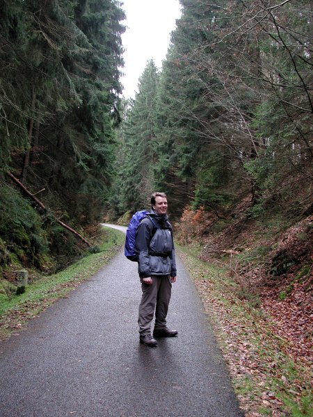
We drove to Wittlich on Friday morning, parked the car at the train station in Wittlich-Wengerohr and took the bus to Daun, where we arrived at around 10:30 am. Instead of hitting the Lieserpfad (Lieser path) right away we found ourselves on the Maare-Mosel-Radweg, which led to a nice detour to one of the volcanic lakes near Daun. Here’s André right after we left Daun.
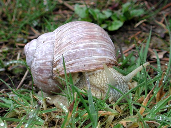
Fortunately, we walked a little faster than this fellow (a grapevine snail):
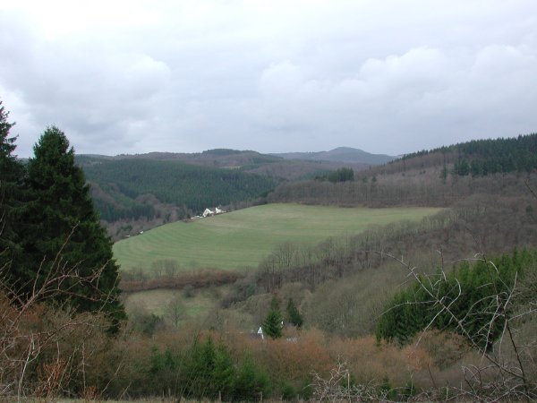
This is what the landscape near Daun looks like. You can see that spring is arriving late this year, all the deciduous trees are still bare.
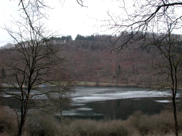
At a quarter past eleven we arrived at the Gemündener Maar. Of the three volcanic lakes near Daun, this one is eerie-looking.
A little while later we hit upon the Lieserpfad and followed it all the way to our destination for the day, Manderscheid. The path follows the Lieser brook, sometimes very close to the bank, sometimes several dozen metres above the Lieser on the slope of a hill. The road is close to the path for a few kilometres in the beginning, but after that you hit the wilderness.
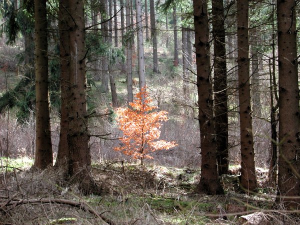
Some trees hang on to their brown leaves all through winter… This was a lone beech tree in a patch of conifers; a few rays of rare sunlight hit it just so.
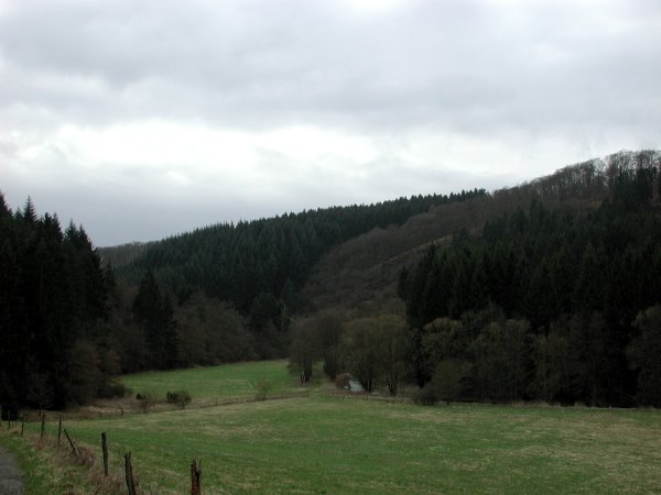
A meadow somewhere along the way.
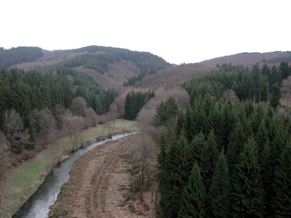
Looking down on the Lieser from a hill:
Around 3:30 pm we arrived in Manderscheid and were greeted by this view of the Oberburg, one of the two castles. As you can see, the weather was less than perfect, but we were not disappointed because it didn’t rain all day even though frequent showers had been forecast.

We strolled through the little town and got a room at the youth hostel (which was a luxurious one with double rooms and private baths, very nice). After relaxing for a bit we went out for an early dinner. By that time the sun had come out, and the castles looked just beautiful in the afternoon light, but of course I had forgotten the camera in our room.
We had dinner at Die alte Molkerei (“the old dairy”) – we were lucky we still got a table at a quarter past six because they were fully booked later in the evening! The food was excellent, though, and they had a large selection of wines.
The next morning we got up fairly early, had breakfast at the youth hostel at the earliest opportunity (7:30 am) and left for the second part of our hike. After making it to Manderscheid much faster than our guidebook had predicted we had high hopes to arrive in Wittlich early in the afternoon – but it turned out that the path drifted much further from the Lieser than the day before and included three steep inclines. I have to admit I also felt the previous days hike in my legs, so it’s not that surprising that today’s hike actually took us longer than the book said it would.
We hit the trail a little before nine o’clock, but stopped right away to take some obligatory photos of the castles. Here’s the Oberburg (upper castle) on the left and the Niederburg (lower castle) on the right. They are about 1,000 and 850 years old, respectively.
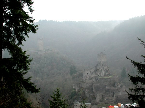
A closer view of the Niederburg:

The second part of the Lieserpfad is more quiet than the first one because it leads through some valleys without houses or roads, only accessible on foot and maybe on horseback. Even though we were not the only ones hiking the trail it almost felt like it for miles on end. The scenery was even more beautiful than it had been the previous day, but it was hard to capture it on film because that would require a proper wide-angle lens – and better weather. We thought that the sun would get out once the fog had lifted, but the sky stayed overcast all day. Oh well, at least it didn’t rain!
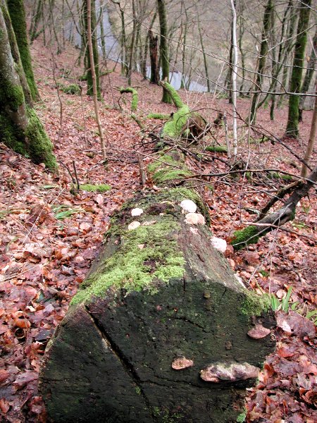
Lots of things grow on fallen trees in the forest – moss, lichen, fungi, and most likely other things I don’t know about.
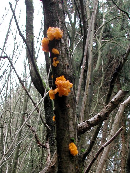
Fungi also grow on living trees. Look at these – the colour looks almost radioactive!
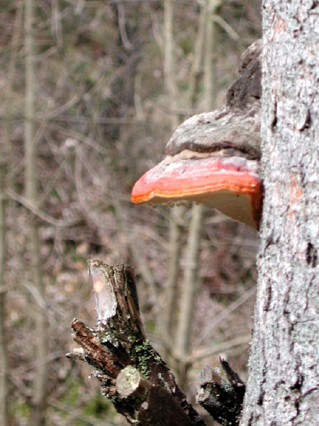
Here’s another fungus that looks less aggressive, but not more palatable than the other one:
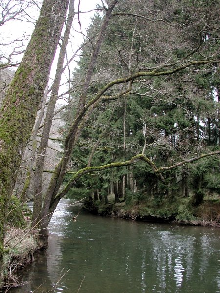
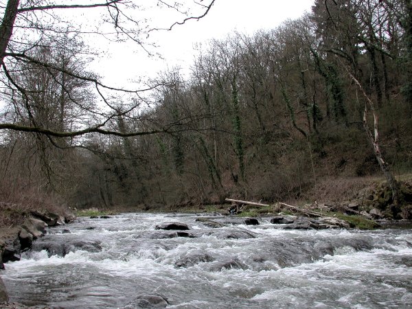
Meanwhile, the Lieser turned into a proper river. We stopped for second breakfast/lunch/whathaveyou twice: at 11 am and at 1 pm. Our first stop was on top of one of the hills we had to cross at a couple of impressive-looking rocks, but I forgot to take a picture. Here’s a view of the Lieser at our second stop:
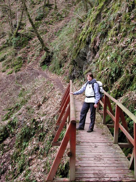
Whenever the slopes were too steep or the path too narrow, small bridges had been built so exhausted hikers (like yours truly) wouldn’t fall off the mountain. I’m actually much more exhausted at this point than I let on. (In fact, I wasn’t doing too badly, but my feet hurt quite a bit. I’m not yet sure if I can blame my new hiking boots – I bought them a short while ago, but took several walks, short hikes and one day hike in them before and never had any problems whatsoever.)
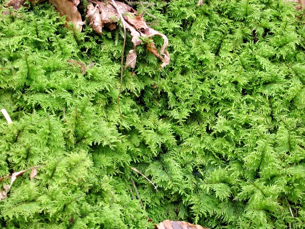
We saw at least four or five different kinds of moss growing on the rocks and trees along the path. Most of it looked like your ordinary kind of moss, but this looked like miniature fern leaves. Note the beech leaf (and another half-decayed leaf) for size comparison.
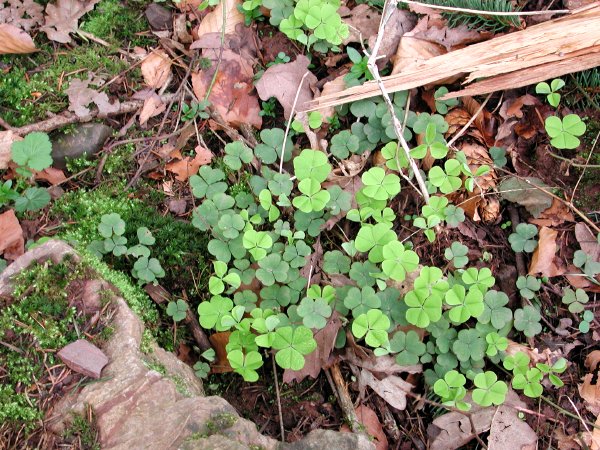
Clover leaves in two colours – is it spring yet?
At a quarter past four we finally reached the outskirts of Wittlich. Here’s one last shot of the Lieser to show you that it really is a river now.
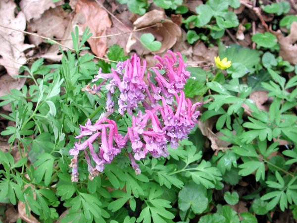
Bulbous Corydalis (corydalis cava, hohler Lerchensporn): these pretty wildflowers grew in many places.
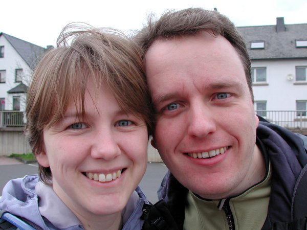
We finally arrived at the central bus station of Wittlich at 4:40 pm and were able to take a bus back to the train station in Wengerohr at 4:47 pm. And this is what two hikers look like after two days and 36 km (24 miles):
Nice! I especially like #5 (the beech tree) and #11 (Lots of things grow on fallen trees in the forest). I looks like you two had a great deal of fun… :-)
Ihr seid ja fast am Hohen List vorbeigekommen!